EarthWorks Features
Earthworks Excavation Takeoff Software. Easy to use. Packed with power. Affordable to everyoneEasy to Learn
With our 220 page full color manual and 6 1/2 hours of training videos built right into EarthWorks, you’ll be productive in no time.
Need more help? We have 5 hours of online training classes every week.
Still more help? Have a question on a drawing you are working on? Send it to us with your question and we’ll make a video of the answer!

Easy to Use
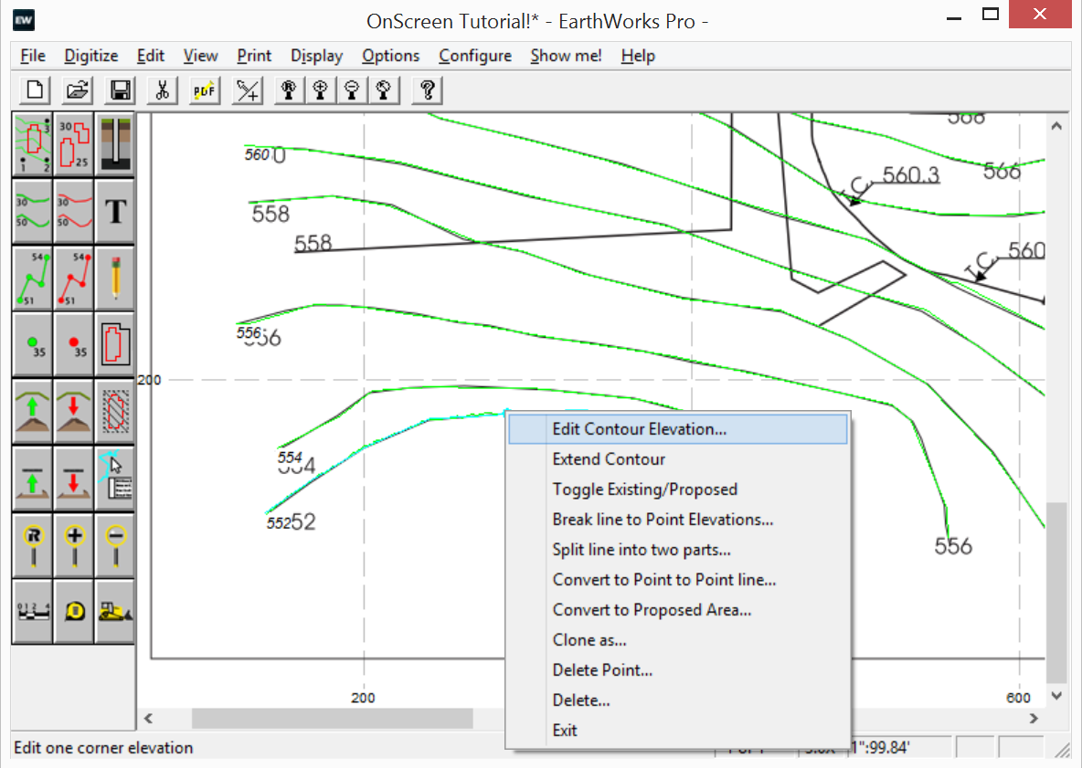
Our #1 design goal in EarthWorks is to “Keep it simple”. Most actions in EarthWorks require only a step or two.
Want to enter something? Just click the icon.
Want to edit something? Just right-click on it.
Want to see where our numbers come from? Just click a spot!
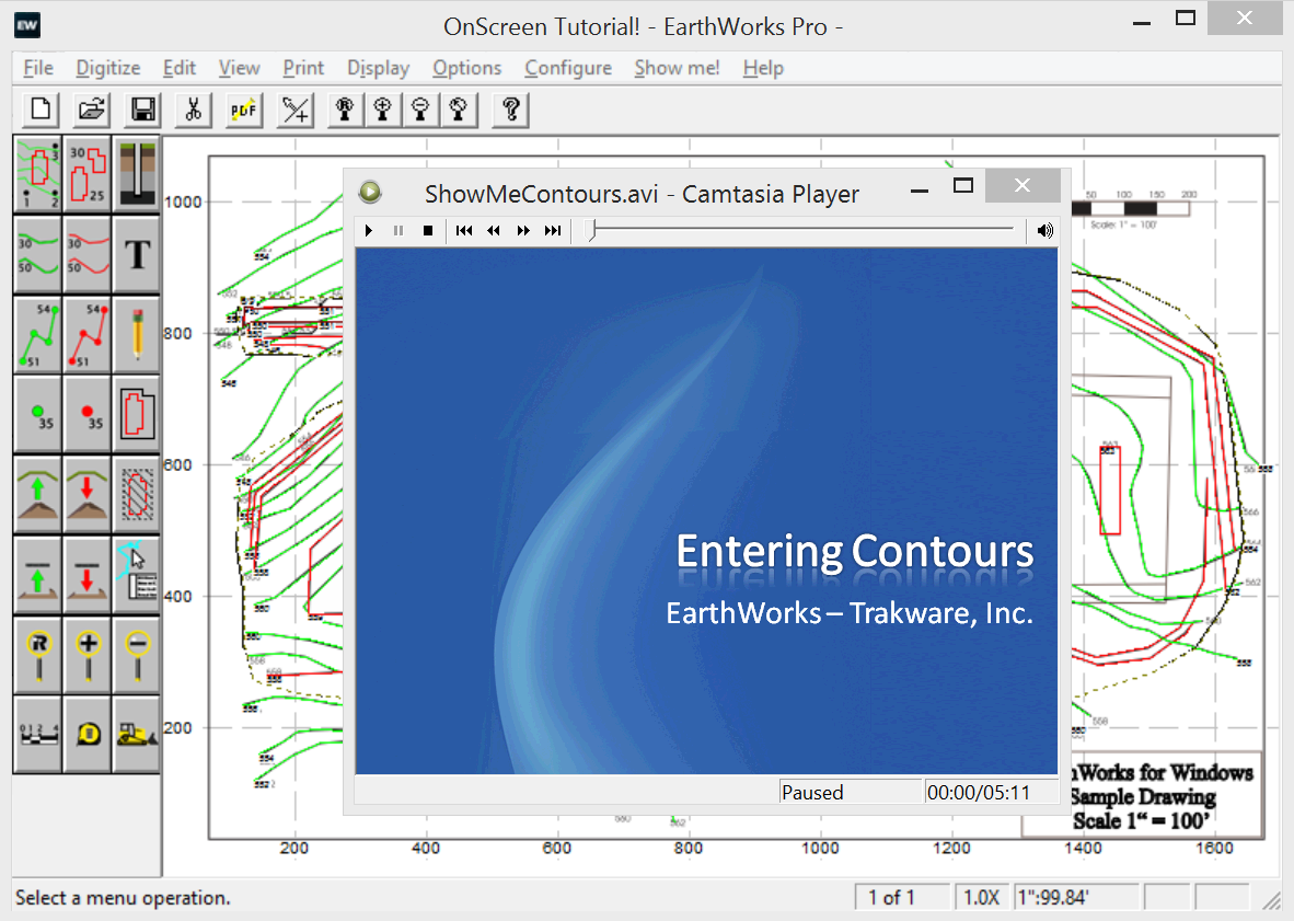
Click the button below to see how easy EarthWorks is to use.
Easy to Check
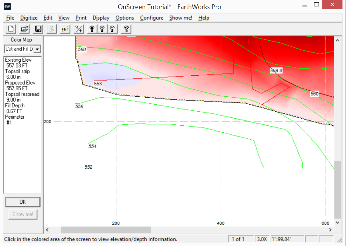
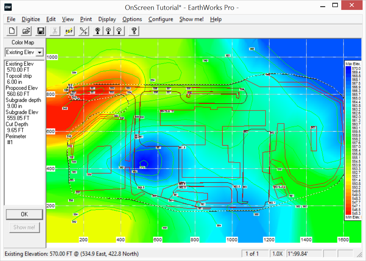
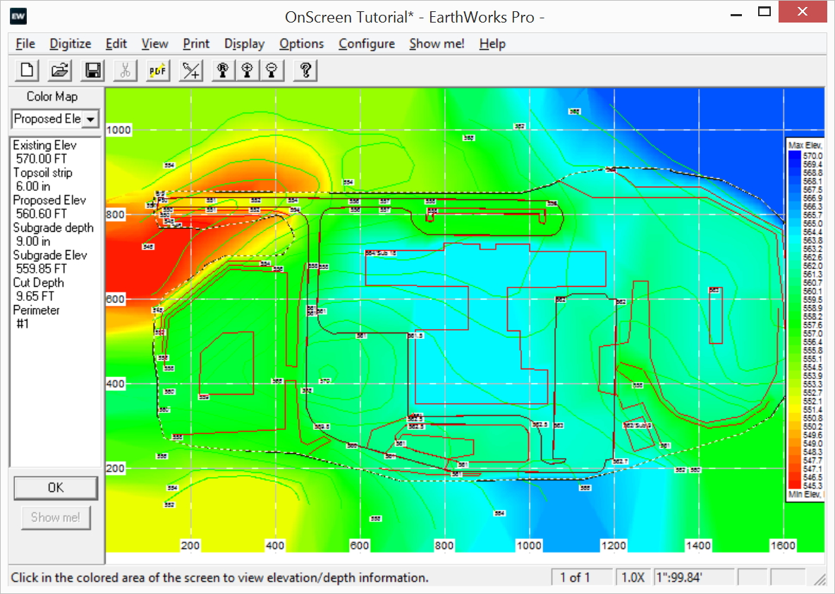
EarthWorks has several features to help you catch any mistakes.
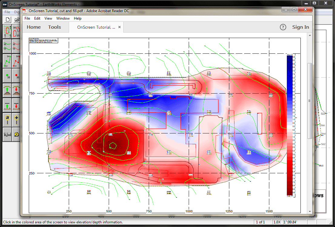
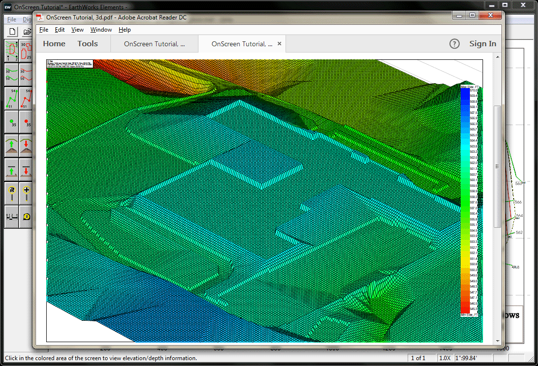
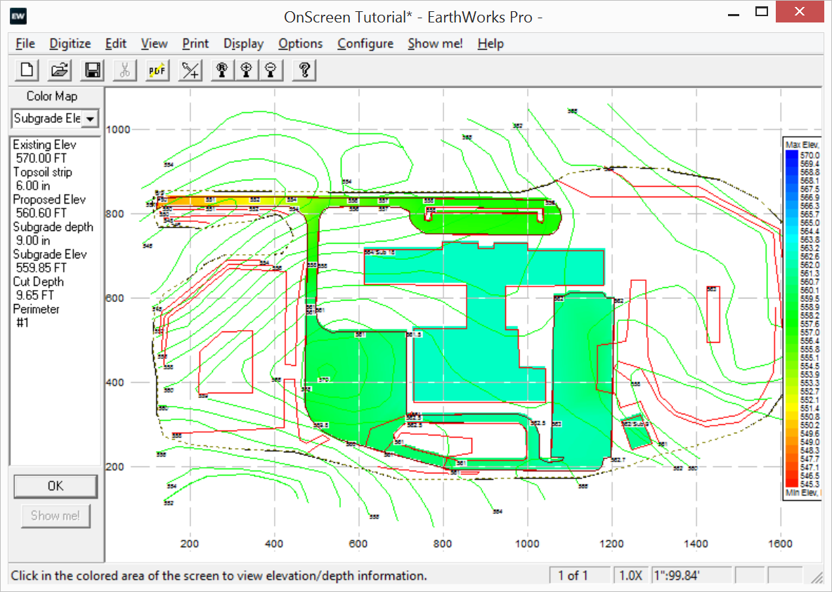
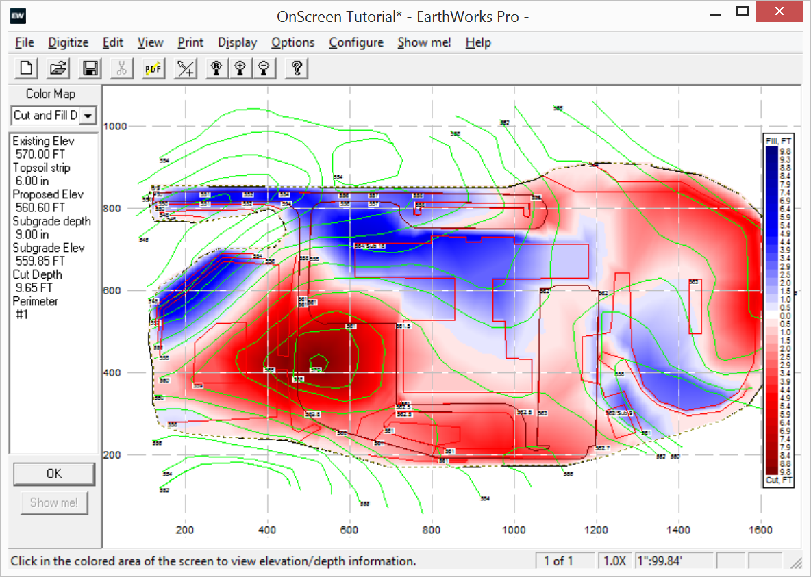
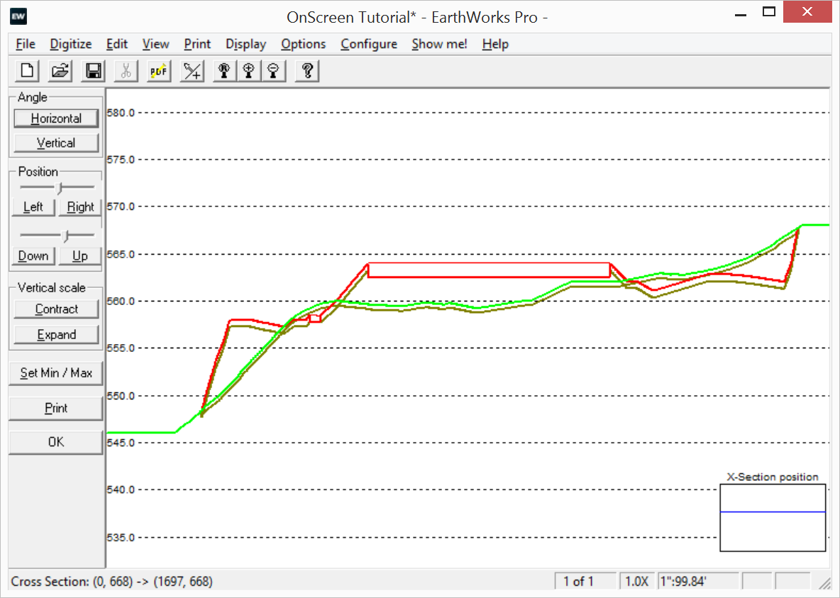
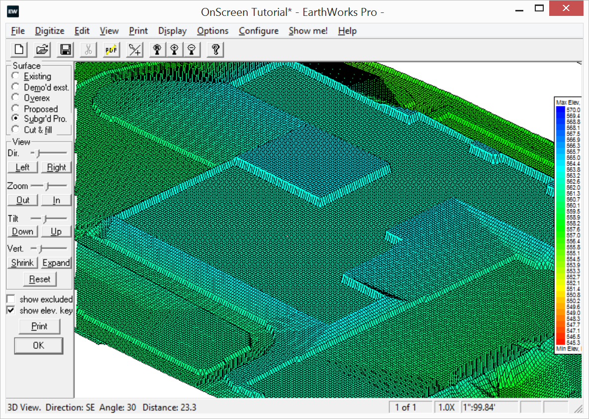
From auto-validation of elevation entries, to screens displaying only suspicious elevations, to flat and 3D color maps of all calculated surfaces including existing, proposed, demoed, subraded, overexed, topsoils and cut/fill where you can see every number, EarthWorks provides you with several different methods to validate your takeoff.

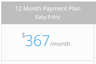

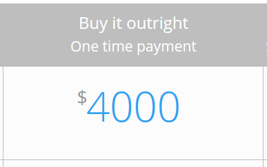

Easy to Afford
EarthWorks is also easy to afford.
Priced starting at only $4000 for the OnScreen version, we offer 4 and 12 month payment plans as well as outright purchases.
We also offer flexible licensing with both local USB license keys as well as network-based floating licenses. That means you can share your EarthWorks licenses around the office or around the world!
No matter what your budget, we can make EarthWorks affordable.
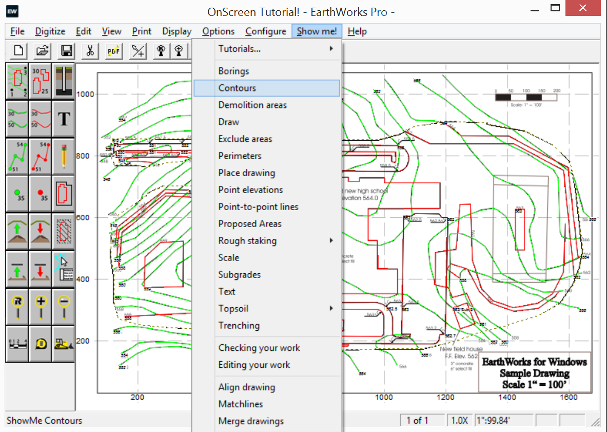
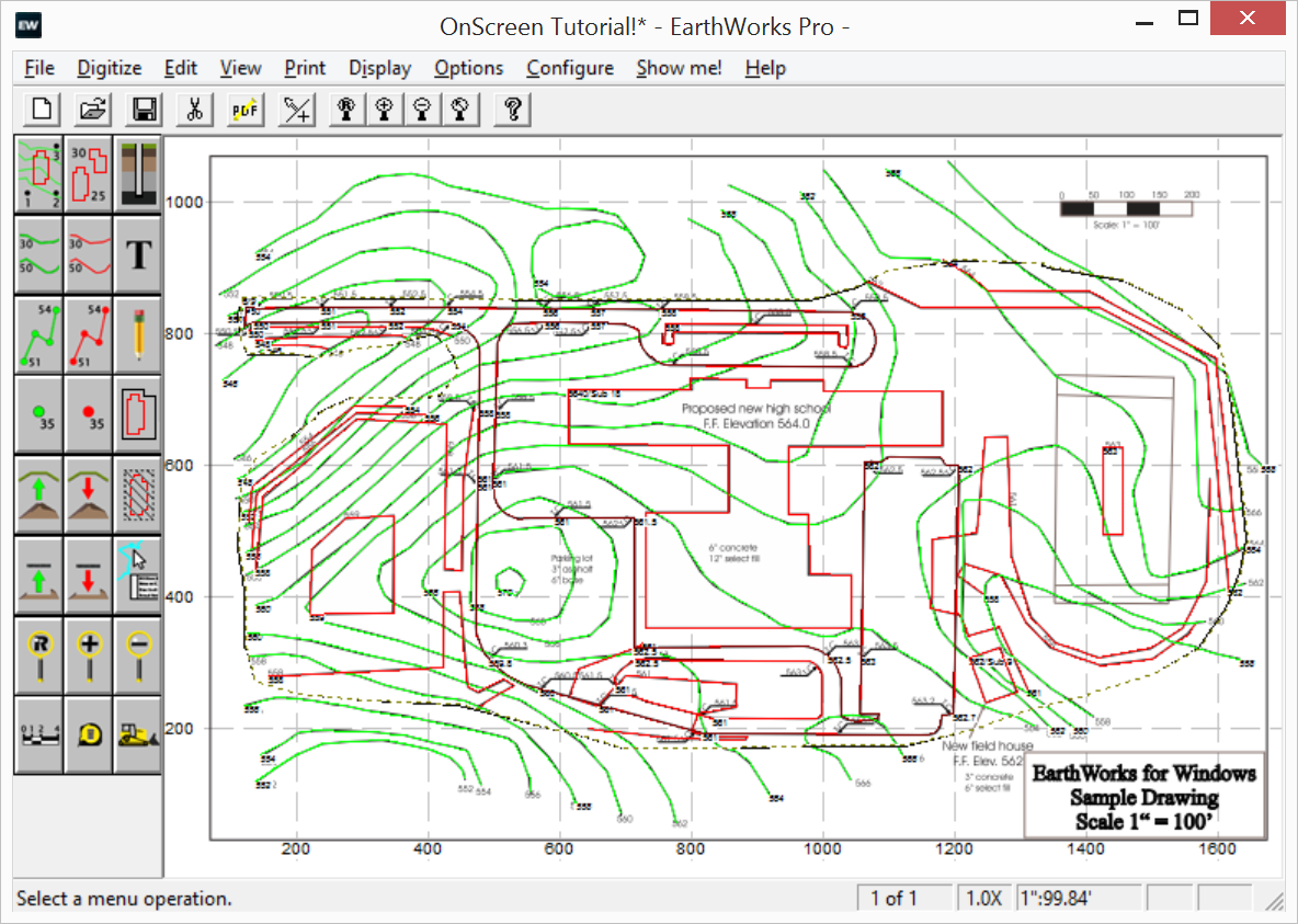
We Have All The Tools You Need!

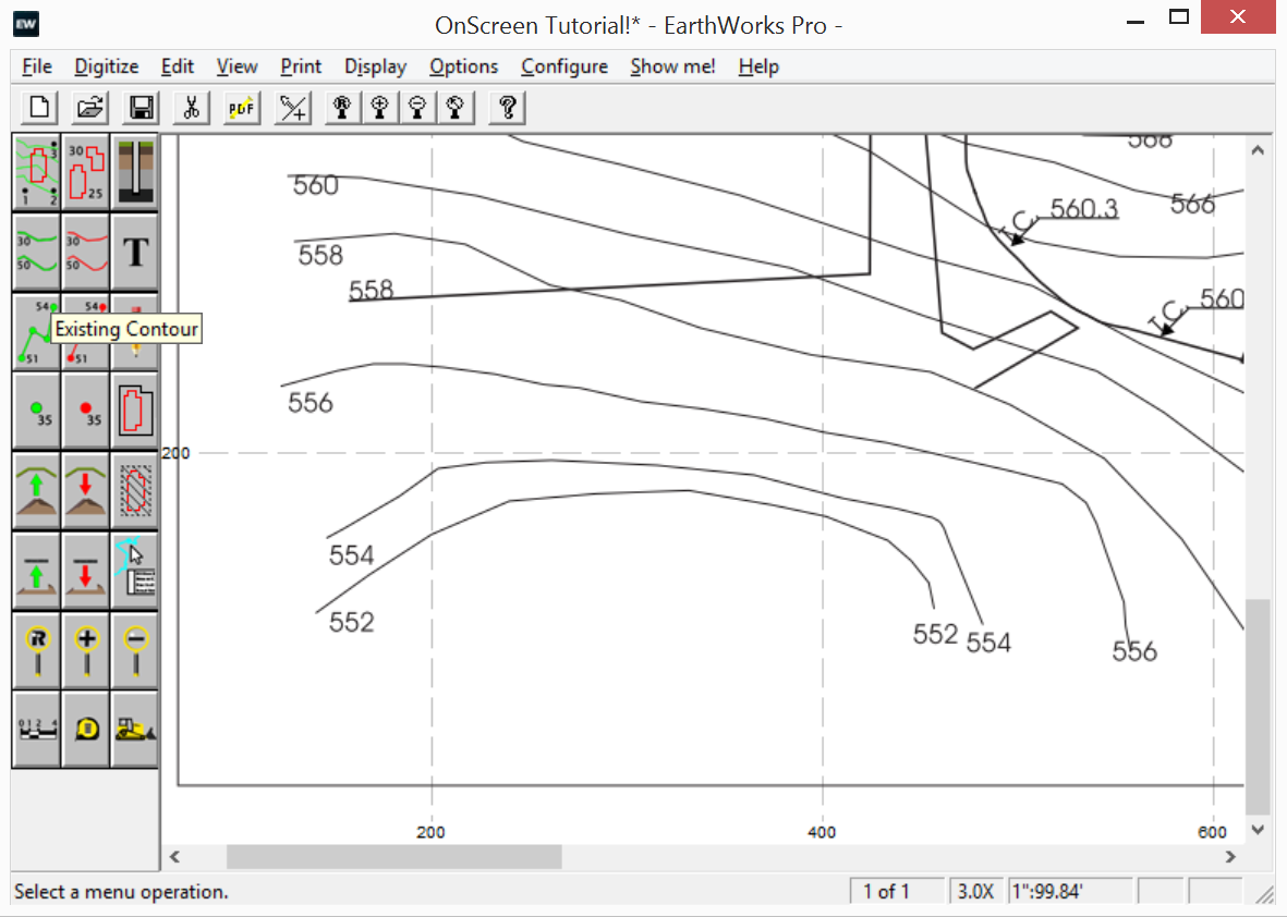
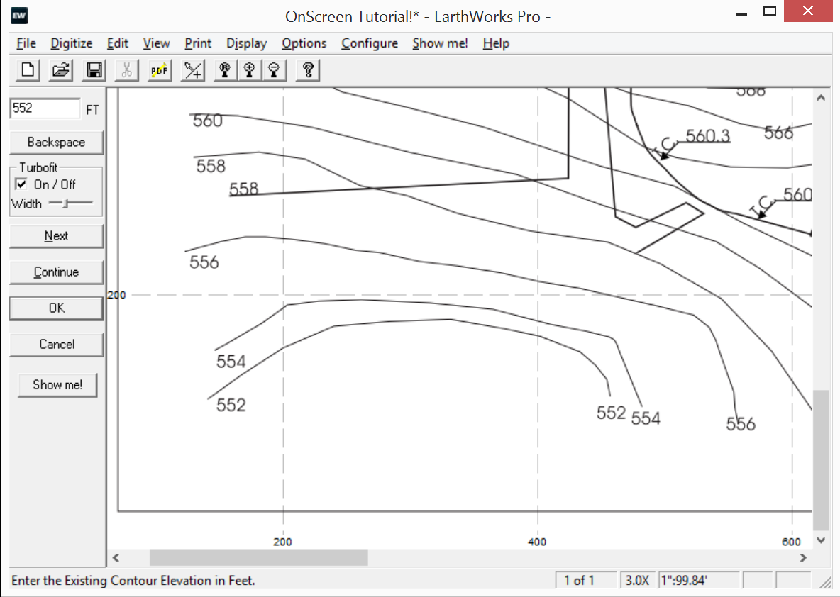
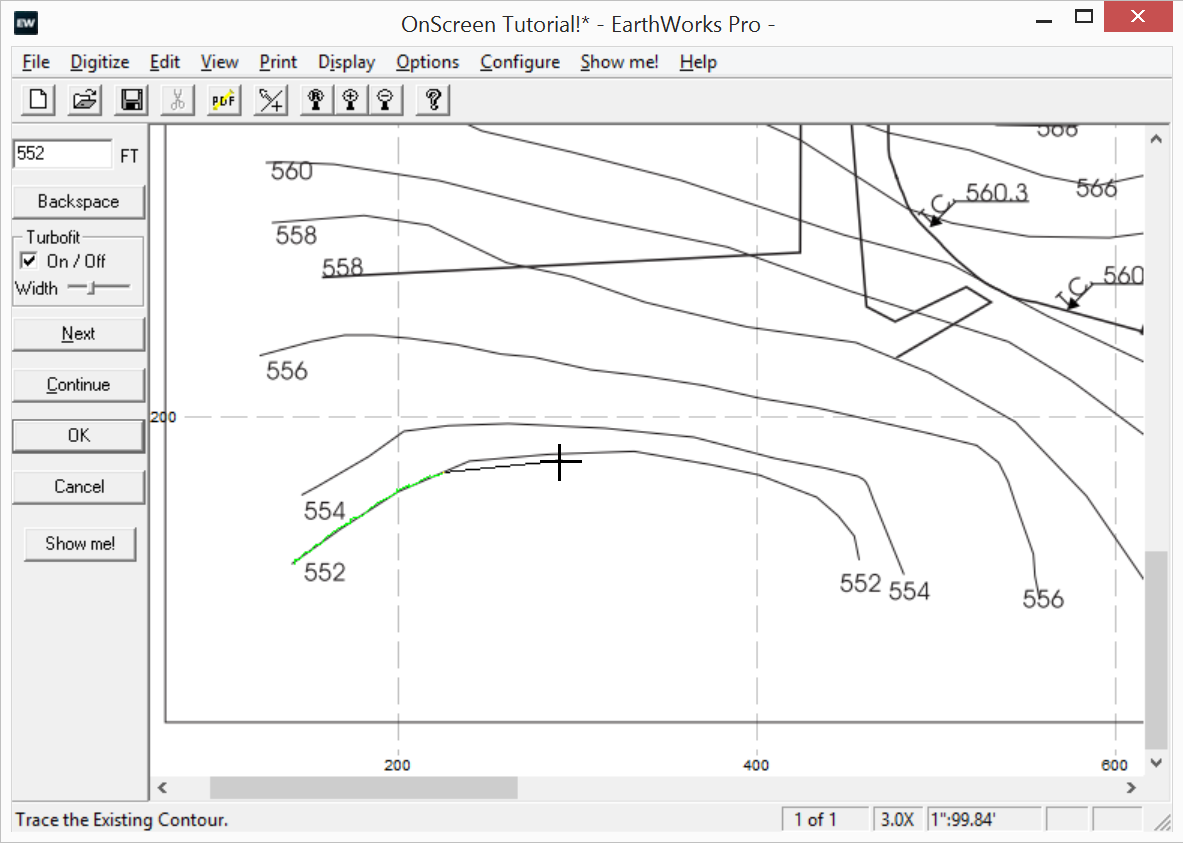
Contour Tool
The Contour tool allows you to enter your contours lines quickly and easily. Use the “Next” button to enter new contours in an ascending or descending elevation series. Use the “Continue” button to enter new contours with the same elevation. Use the TurboFit option to “stick” your contours to the contours on the drawing.

Point-to-Point Tool
The Point-to-Point tool allows you to enter curblines, sidewalks and flowlines with ease. It even calculates the elevations between known points for you. You can also copy Point-to-Point lines on either side with slopes or grades to make entering roadways a breeze.

Point Tool
The Point Tool allows you to enter any number of point elevations. Just enter the elevation and click.

Area Tool
The Proposed Area tool allows you to put in flat and level areas such as building pads, pond bottoms, and equipment pads. You can also specify concrete and base materials as well as specifying overexcation and engineered fill requirements.

Topsoil Strip Tool
Use the Topsoil Strip tool to strip one or more areas of topsoil from your site. Is there topsoil in your Borings? Then EarthWorks will use that information to determine the exact depths of topsoil to strip. Want to respread topsoil everywhere EXCEPT where your buildings, parking lots and sidewalks are? The use the Auto-Respread option to respread your topsoil quickly and easily.

Topsoil Respread Tool
The Topsoil Respread tool allows you to quickly and easily respread your topsoil in any number of areas on your site. The respread tool will automatically override the auto-respread. This allows specific areas to have more, less or no respread at all.

Demolition tool
The Demolition Tool allows you to remove materials before the excavation begins. Great for getting rid of old parking lot materials, construction waste or site grubbing.

Subgrade Tool
The Subgrade Tool allows you to account for your parking lot and sidewalk materials. You can either trace it in or clone existing curblines to create them. Subgrades cloned from curblines automatically look for and subtract curblines around islands.
You can also specify overexcavation and engineered fill for your subgrade areas.

Borings Tool
The Borings tool allows you to enter any number of borings with any number of strata. Strata can be entered with either elevations or depths. Strata information is automatically carried forward as you enter each boring so that strata only need to be entered once. Any topsoil information will be used automatically to calculate the depth of any topsoil strip areas.

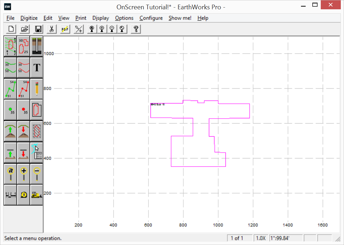
Perimeter Tool
Use the Perimeter tool to define the outer boundary of your work area. Nest Perimeters inside of it to generate subtotal reports by perimeter number for specific areas inside your work area.

Measuring Tool
The Measuring Tool allows you to measure any number of areas, lengths and counts. You can name any measurement and view and print your measurement reports.

Pipe Trench Tool
The Pipe Trench tool can be used to enter any number of pipe trenches with any number of points. Each trench can contain up to 10 pipes. The trench can also have a bedding layer as well as two backfill layers.
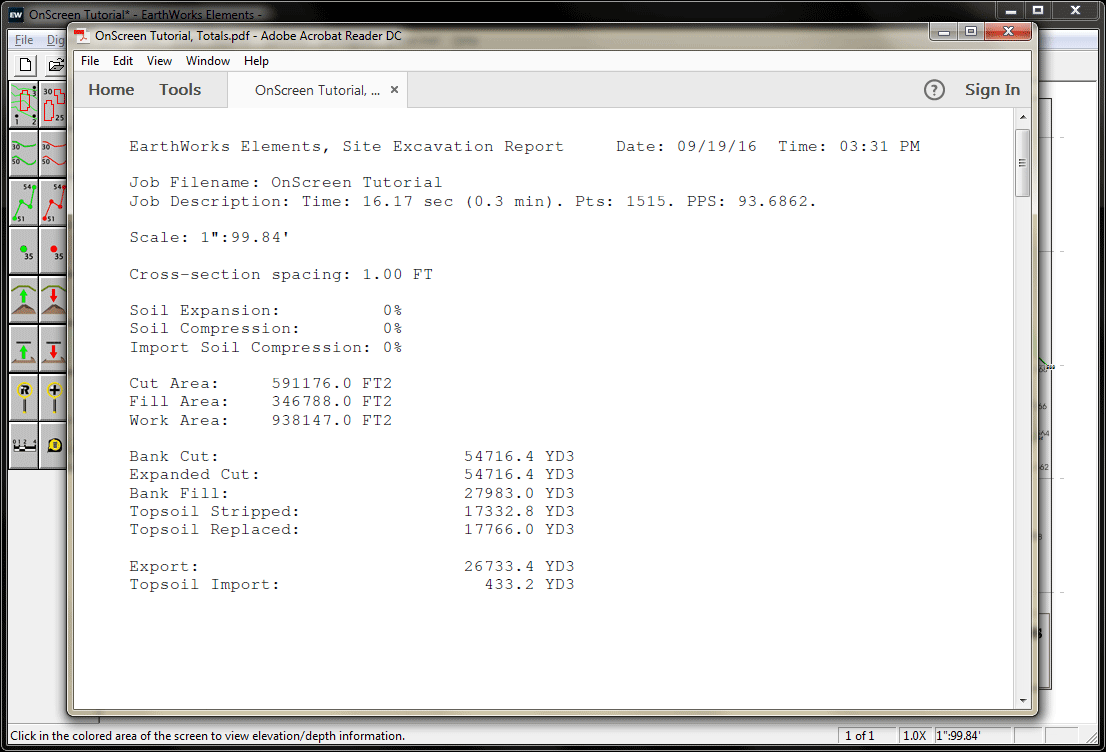
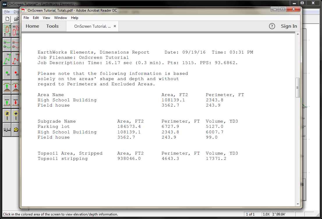
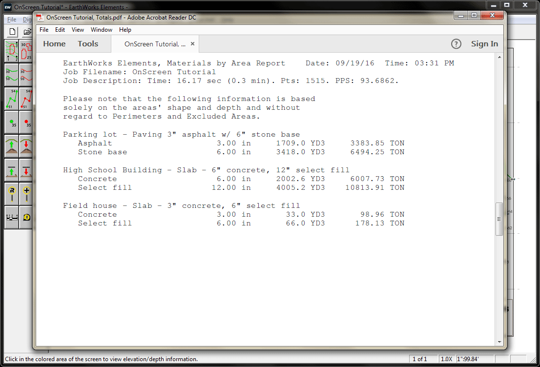
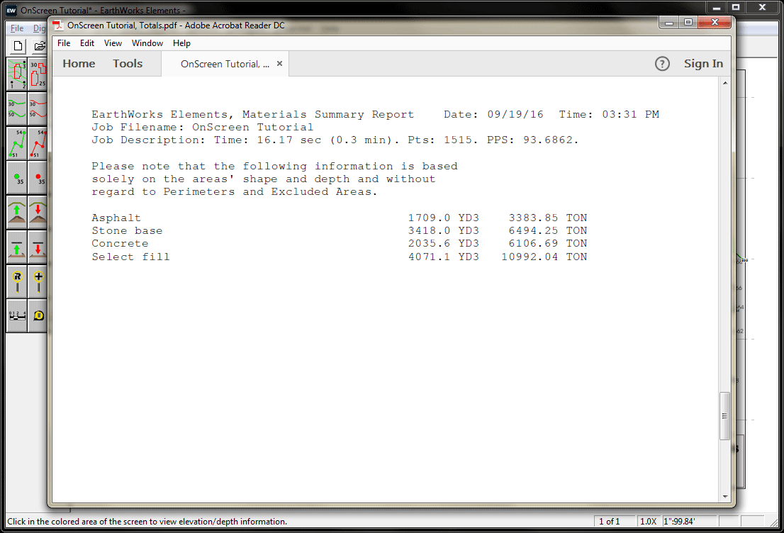
All The Reports You Want